
Doug Kerr
Well-known member
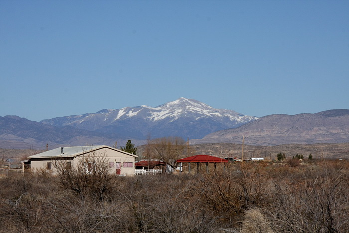
About 30 miles (48 km) north-northeast of Alamogordo is Sierra Blanca Peak, the highest mountain peak in southern New Mexico, at 11,981 ft (3,652 m) above mean sea level (MSL). Its topographic prominence (a measure of how it rises above its surroundings) is 5,533 ft (1,686 m).
Here we see it from US 54 just a few miles north of Alamogordo:
Douglas A. Kerr: Sierra Blanca Peak
It is normally snow-covered for much of the winter.
It is part of the Sierra Blanca Range, and is within the Mescalero Apache Indian Reservation.
In contrast, the highest points in the Sacramento Mountains (the ones that start a few blocks to the east of our new home in Alamogordo), just to the south of the Sierra Blanca Range, are at an elevation of "only" 9,695 ft.
Our new home is at 4600 ft MSL. Our road continues into the mountain, and ends at an elevation of very nearly one mile (5280 ft.).
This is beautiful country!
Best regards,
Doug
")